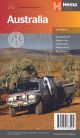
Hema Australia Road & Terrain Map

A road and terrain map of Australia that is coloured to reflect the country's climate zones and features major road networks, Outback fuel, distances and major national parks.
- Photographic guide to Australia's most iconic four-wheel driving destinations
- Includes destinations such as including the Kimberley, Cape York, the Top End, Fraser Island, Corner Country, High Country Victoria, the Flinders Ranges, the Red Centre, South West Western Australia and the Pilbara
- Scale of 1:4,500,000
$12.99

SKU
9781925625943

Key Features
- Full road and terrain map
- Major road networks
- Fuel availability
- Climate zones
- Major National parks
- A photographic guide to Australia's most iconic four-wheel driving destinations
- Distance grid
- Index
Key Specifications
- Scale: 1:4,500,000
- Folded size (WxHxD): 140mm X 250mm x 3mm
- Flat size (WxH): 700mm X 1000mm
- Weight: 0.09kgs
Pick Up
Unfortunately we currently do not offer customer pick ups
How much does shipping cost?
Shipping is a flat fee of $9.95, there may occasionally be an extra freight charge if items purchased are heavy, bulky or being delivered to a regional or remote location, but we will notify you via email if this occurs
How long will Shipping Take?
Metro Areas
Usually between 1-7 business days since time of order
Rural Areas
Rural areas can take anywhere between 1-10 business days depending on where you are located