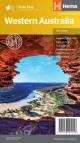
Hema Western Australia Handy Map

A compact map of Western Australia perfect for touring throughout the state with a distance grid and index for planning and reference.
- Fully indexed
- Includes information areas. Caravan parks, lookouts and more!
- Easy to use


A compact map of Western Australia for touring throughout the state with a distance grid and index for planning and reference. Marked on the mapping are highways, major and minor roads, camping and rest areas, 24-hour fuel, information centres, picnic areas, caravan parks and lookouts.
Scale: 1:2,500,000
Folded size (WxHxD): 125mm X 250mm x 3mm
Flat size (WxH): 500mm X 875mm
Weight: 0.09kgs
Pick Up
Unfortunately we currently do not offer customer pick ups
How much does shipping cost?
Shipping is a flat fee of $9.95, there may occasionally be an extra freight charge if items purchased are heavy, bulky or being delivered to a regional or remote location, but we will notify you via email if this occurs
How long will Shipping Take?
Metro Areas
Usually between 1-7 business days since time of order
Rural Areas
Rural areas can take anywhere between 1-10 business days depending on where you are located